
Professional Context
The cartography and photogrammetry industry is plagued by the perpetual challenge of balancing accuracy with efficiency, as the sheer volume of geospatial data continues to grow exponentially, making it increasingly difficult to produce high-quality maps and 3D models without sacrificing precious time or resources.
💡 Expert Advice & Considerations
A common trap is relying on this tool to generate entire maps from scratch, it's a waste of time, instead use it to automate tedious tasks like data cleaning and feature extraction, so you can focus on the actual cartography and photogrammetry work.
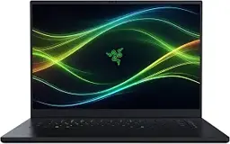
Recommended hardware for AI workflows
Razer Blade 16
High-end GPU laptop for rendering, machine learning, and creative pros.
As an Amazon Associate, ProfessionPrompts earns from qualifying purchases.
Advanced Prompt Library
4 Expert PromptsOrthorectification Parameter Optimization
I have a dataset of aerial images taken over a rugged terrain with varying levels of relief displacement, and I need to optimize the orthorectification parameters to minimize residual distortions, taking into account the sensor's calibration parameters, the platform's altitude and velocity, and the terrain's digital elevation model; provide a step-by-step workflow to achieve this, including the mathematical formulas and software tools required, assuming a rational function model and aDEM with 1-meter resolution.
Change Detection Analysis for Urban Development
Given two sets of satellite images of an urban area taken at different times, with different spectral and spatial resolutions, I need to perform a change detection analysis to identify areas of new construction, land use conversion, or infrastructure development, using a combination of spectral and spatial analysis techniques, such as image differencing, regression analysis, and object-based image analysis; provide a detailed methodology, including the pre-processing steps, feature extraction, and classification algorithms, as well as the software tools and libraries required, assuming a multispectral image with 4 bands and a spatial resolution of 5 meters.
Geometric Calibration of a Non-Metric Camera
I have a non-metric camera with unknown interior orientation parameters, and I need to perform a geometric calibration to determine the camera's focal length, principal point, and distortion coefficients, using a set of images taken of a calibration target with known 3D coordinates; provide a step-by-step guide on how to extract the calibration parameters, including the mathematical models and software tools required, assuming a pinhole camera model and a calibration target with a checkerboard pattern.
Terrain Mapping for Flood Risk Assessment
I need to create a high-resolution terrain map of a flood-prone area, using a combination of LiDAR point cloud data and aerial imagery, to identify areas of high flood risk and prioritize mitigation efforts, taking into account the terrain's topography, land use, and soil type; provide a detailed workflow, including the data pre-processing steps, point cloud classification, and terrain modeling algorithms, as well as the software tools and libraries required, assuming a LiDAR point cloud with 10 points per square meter and an aerial image with 0.5-meter resolution.
Alternative AI Workflows
Discover how different language models approach tasks for this specific profession.

ChatGPT Prompts for Cartographers and Photogrammetrists
Explore ChatGPT-optimized templates

Claude Prompts for Cartographers and Photogrammetrists
Explore Claude-optimized templates

Gemini Prompts for Cartographers and Photogrammetrists
Explore Gemini-optimized templates

Perplexity Prompts for Cartographers and Photogrammetrists
Explore Perplexity-optimized templates

Jasper Prompts for Cartographers and Photogrammetrists
Explore Jasper-optimized templates
Frequently Asked Questions
What are the best Grok prompts for Cartographers and Photogrammetrists?+
The cartography and photogrammetry industry is plagued by the perpetual challenge of balancing accuracy with efficiency, as the sheer volume of geospatial data continues to grow exponentially, making it increasingly difficult to produce high-quality maps and 3D models without sacrificing precious time or resources. This page provides 4 expert, copy-paste Grok prompts crafted specifically for Cartographers and Photogrammetrists, each with a clear use case and customization notes.
What tasks do these Grok prompts help Cartographers and Photogrammetrists with?+
They cover tasks such as Orthorectification Parameter Optimization, Change Detection Analysis for Urban Development, Geometric Calibration of a Non-Metric Camera, Terrain Mapping for Flood Risk Assessment.
What should Cartographers and Photogrammetrists keep in mind when using Grok?+
A common trap is relying on this tool to generate entire maps from scratch, it's a waste of time, instead use it to automate tedious tasks like data cleaning and feature extraction, so you can focus on the actual cartography and photogrammetry work.
How many Grok prompts are included, and are they free?+
There are 4 ready-to-use Grok prompts on this page. They are free to copy and use, and you can adapt each one to your specific situation.
Cartographers and Photogrammetrists
DashboardWorkflows
5